
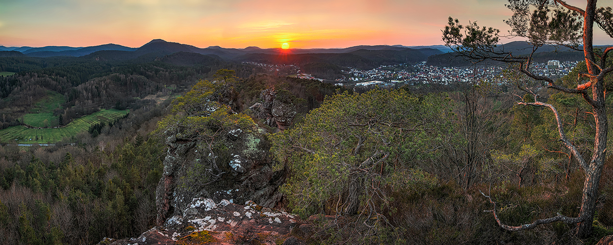
HOCHSTEIN NEAR DAHN
East of Dahn the Hochstein rises 345 m. It is one of the numerous colored sandstone formations that are mainly found in this area. The rock chain of the Hochstein stretches for about 1.5 km. The western end of the massif, the Hochsteinnadel, is particularly striking. This is followed by the Gratturm and the actual Hochstein ridge, after which further foothills continue to the northeast and south.
Professional tips:
-
- Season: May, September; even in snow e.g. in December
-
- Time of day: 06:00 p.m. – 08:00 p.m.
-
- Weather: Clouds with sun spots, fog, sunset
-
- Lenses: 16-35 mm, 35 mm, 24-70 mm, 70-200 mm details
-
- Filter: Polarizing filter and soft gray gradient GND 16, GND 8
-
- Tripod: Yes
-
- Location: Hochstein plateau. Here you have a wonderful view of the Dahner Felsenland and Dahn in the front area, night shots are also excellent at this location
Directions and location:
In Dahn to the house at the Kurpark, there on Priminiusstraße to the end, then right on a paved path to the German war cemetery. From there, a marked path goes steeply uphill for approx. 600 m to the Hochstein plateau (past a rock shelter called the soldiers‘ hut).
Coordinates: 49.146173, 7.78945
Hiking trails nearby
Climbing spots nearby