
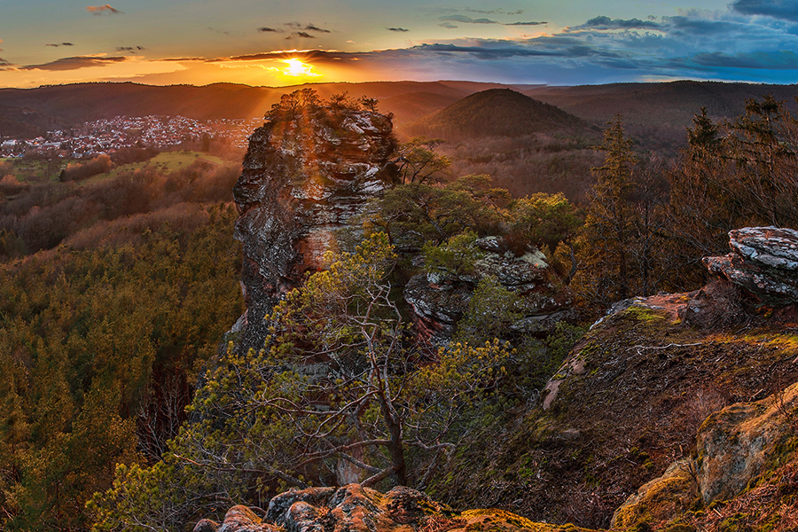
SPIRKELBACHER RAUHFELS
The Spirkelbacher Rauhfels is one of a total of three red sandstone rocks on the 371 meter high small Rauhberg (also called Spirkelbacher Rauhberg). The 46-meter-high rock is located in the municipality of Spirkelbach within the municipality of Hauenstein. The access to the small Rauhberg can be done via Spirkelbach as well as via Hauenstein. The red sandstone rocks can each be reached via partly signposted paths. With the tours of the Rauhfels there is something for everyone due to many different degrees of difficulty. In addition to the Rauhfels, the Rauhbergpfeiler, which is located on the southern slope of the mountain, also offers numerous climbing routes for somewhat more experienced climbers.
Here you can find a short summary for “Spirkelbacher Rauhfels” as download (german version).
Fact sheet:
Location: Spirkelbach, municipality of Hauenstein
Coordinates: Hauptgipfel-Massiv: 49°11´50″N, 7°52´23″E
Maximum height: 46 meters
Difficulty: mainly easy to moderate tours
Summit book: yes
4 sectors: Süd- und Ostwand, Nordwand, Massiv – Linke Südwand, Massiv – Rechte Südwand
Special features: Also conditionally suitable for climbing in winter. Beautiful views over the surrounding area.
Hiking trails nearby
Photo spots nearby
More Climbing spots nearby